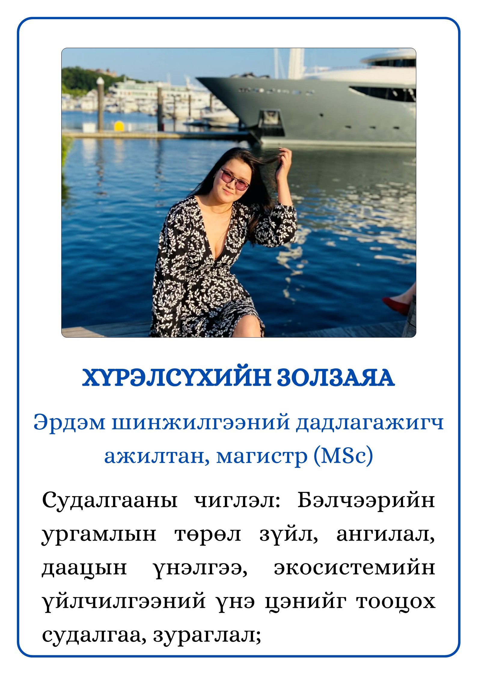
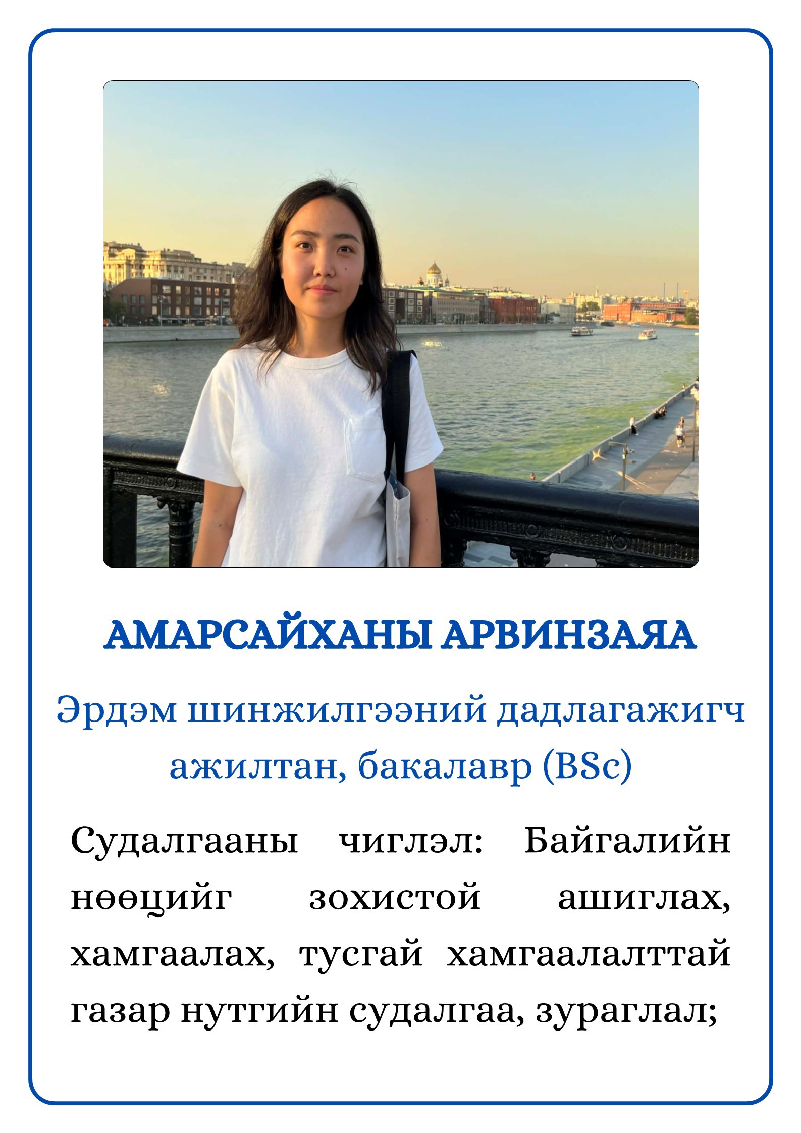
Физик газарзүйн салбарын дарга
Эрдэм шинжилгээний ахлах ажилтан
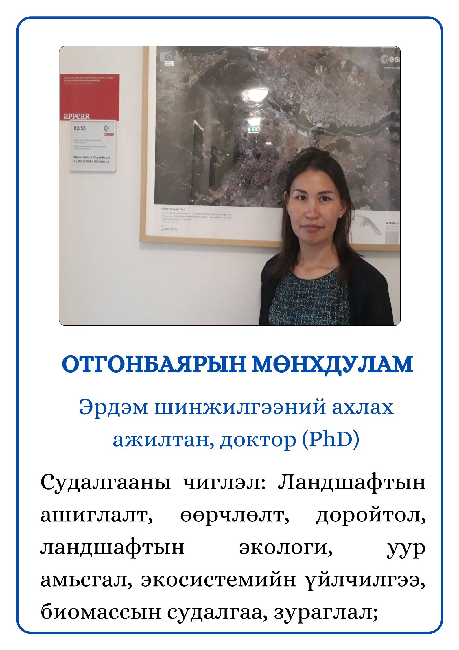
Газарзүйн ухааны доктор (Ph.D) О.Мөнхдулам
Цахим шуудан: munkhdulamo@mas.ac.mn
Утас: 976-88553365
https://orcid.org/0000-0002-6004-7551
Эрдмийн зэрэг хамгаалсан улс, сургууль: 2023, Япон улс Нагояагийн их сургууль
Зорилго
Монгол орны физик газарзүйн иж бүрэн судалгааг олон улсын түвшинд нийцүүлэн тогтмол явуулах, салбарын гадаад хамтын ажиллагааг өргөжүүлэх,орчин үеийн шинэлэг аргазүйг нэвтрүүлэх, байгалийн бүс, бүслүүрүүдэд экосистемийн мониторинг судалгааны төв байгуулах, Монгол улсын урт, дунд хугацааны байгаль орчны бодлогын баримт бичгүүдийг хэрэгжүүлэхэд физик газарзүй, хүрээлэн буй орчны онолын болон практик судалгааны үр дүн, шинжлэх ухааны үндэслэлээр дэмжлэг үзүүлнэ.
Үйл ажиллагааны үндсэн чиглэл
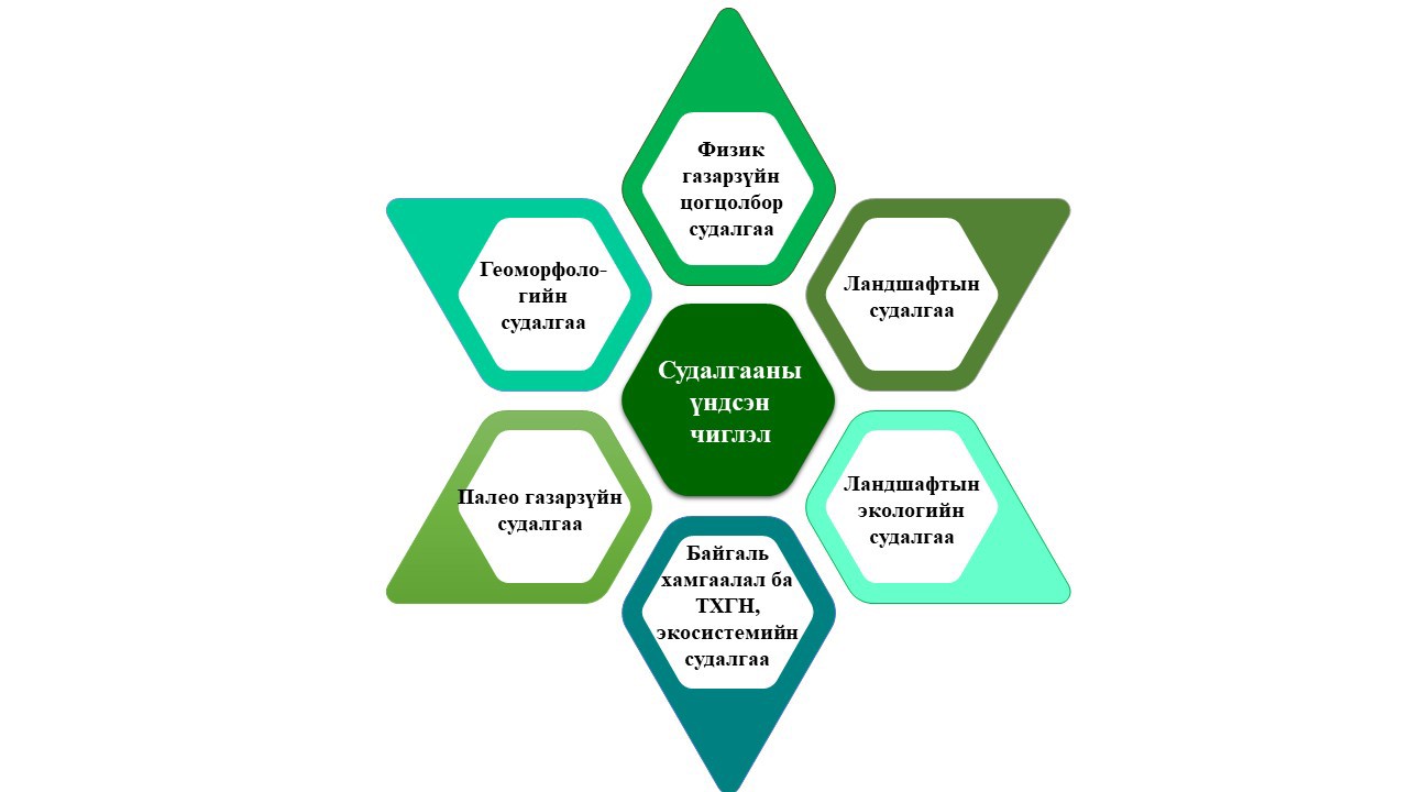
Физик газарзүйн цогцолбор судалгаа
Тодорхой бүс нутаг, сав газрын болон үндэсний хэмжээнд физик газарзүйн цогцолбор судалгаа явуулж, байгалийн нөөц, баялгийг зохистой ашиглах, байгаль хамгаалах (улсын тусгай хамгаалалттай газар нутаг)-д чиглэсэн шинжлэх ухааны үндэслэлтэй тайлан, ном, зөвлөмж, гарын авлага, сэдэвчилсэн зураг боловсруулах;
Ландшафтын судалгаа
Ландшафтын бүтэц, бүрэлдэхүүн, төлөв байдал, ангилал, тархалтын зүй тогтлыг судалж, шинжлэх ухааны үндэслэлтэй тайлан, ном, зөвлөмж, гарын авлага, сэдэвчилсэн зураг боловсруулах;
Ландшафтын экологийн судалгаа
Ландшафтын ашиглалт, өөрчлөлт, доройтол, төлөвлөлт, ландшафт-нутаг дэвсгэрийн зохистой бүсчлэл, ландшафтын экологийн чиглэлээр судалгаа явуулж, шинжлэх ухааны үндэслэлтэй тайлан, ном, зөвлөмж, гарын авлага, сэдэвчилсэн зураг боловсруулах;
Геоморфологийн судалгаа
Хотгор гүдгэрийн үүсэл, хөгжил (эндоген, экзоген), морфогенетик хэв шинж, газрын гадаргын нөхцөл, морфодинамик (тектоник хагарал, үер, элсний нүүлт хөдөлгөөн) үзэгдэл, үйл явцыг судалж, шинжлэх ухааны үндэслэлтэй тайлан, ном, зөвлөмж, гарын авлага, сэдэвчилсэн зураг боловсруулах;
Палеогазарзүйн судалгаа
Эртний уур амьсгал, эртний нуур, хурдас хуримтлал, агуй, газарзүйн хөгжлийн түүхэн хувьслыг судалж, шинжлэх ухааны үндэслэлтэй тайлан, зөвлөмж, гарын авлага, сэдэвчилсэн зураг боловсруулах;
Хүрээлэн буй орчин, экосистемийн судалгаа
Хүрээлэн буй орчны төлөв байдал, байгалийн бүс бүслүүр судалгаа, экосистемийн үйлчилгээний үнэ цэнэ, төлбөр тооцох судалгаа хийж, шинжлэх ухааны үндэслэлтэй тайлан ном, зөвлөмж, гарын авлага, сэдэвчилсэн зураг боловсруулах;
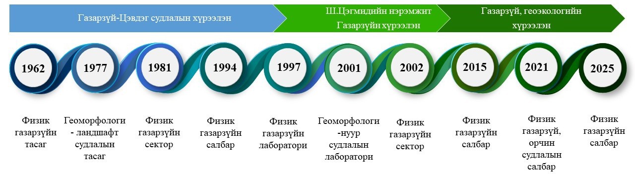
Түүхэн замнал
Физик газарзүйн судалгааны түүх нь 1924 онд Судар бичгийн хүрээлэнгийн бүрэлдэхүүнд “Газарзүйн кабинет” байгуулагдаж, ЗХУ-ын нэрт эрдэмтэн А.Д.Симуковоор ахлуулан баг анхны судалгаануудыг явуулснаар академик судалгааны үндэс тавигдсан гэж үздэг. Уг кабинетын үйл ажиллагаа өргөжин хөгжиж, 1962 онд ШУА-ийн дэргэд Газарзүй-Цэвдэг судлалын хүрээлэн байгуулагдахад түүний бүрэлдэхүүнд шилжин орж, анхны дөрвөн тасгийн нэг болох “Физик газарзүйн тасаг” нэртэй болсноор уг салбарын түүх албан ёсоор эхэлж, Монгол улсын Шинжлэх Ухааны Гавьяат Зүтгэлтэн, доктор Ж.Цэрэнсодном гуайгаар удирдуулсан судлаачид физик газарзүйн дагнасан судалгаа хийх ажлын гараа эхэлсэн. Өөрөөр хэлбэл, тус тасаг байгуулагдсанаар Монголын газарзүйн шинжлэх ухааны хөгжлийн түүхэнд шинэ үе эхэлж, салбарын дотоод бүтэц, судалгааны чиглэлүүд өргөжин тэлж, онолын болон туршилтын судалгааг өргөн хүрээнд далайцтай явуулах эрдэм шинжилгээ, туршилтын суурь чадавх бүрэлдэн бий болсон.
Салбараас төрсөн эрдэмтэд
- Цэгмид Ш. Хэнтийн уулархаг орны физик газарзүйн тодорхойлолт ба эртний мөстөл. ЗХУ, 1951
- Жигж С. Хэнтийн уулархаг орны геоморфологи. ЗХУ, 1972
- Цэрэнсодном Ж. Монгол орны нуур, түүний ач холбогдол. БНМАУ, 1972
- Бадарч Н, Монгол орны уур амьсгал. БНМАУ, 1972
- Нацаг Ж. Сэлэнгийн савын голуудын тууш зүсэлт ба гольдрол бүрэлдэн тогтох нь. ЗХУ, 1977
- Ломборинчен Р. Хангай, Хэнтийн уулархаг орны хотгор гүдгэрийг өөрчлөгч үйл явц. ЗХУ, 1989
- Санжмятав З. Хажуугийн урсац, хөрсний угаагдал үүсэж бүрэлдэх зүй тогтол, түүнийг зохицуулах арга зам. Монгол улс, 1993
- Цолмон П. Монгол орны гандуу нутгийн цөлжилт. Туркмен улс, 1994
- Сарантуяа Н. Гандуу нутгийн экосистемийн доройтлын үйл явцыг оношлох аргазүйн асуудал. ОХУ, 1994
- Батнасан Н. Говийн томоохон нууруудын усзүйн систем, усны горим, түүний хувьсал өөрчлөлт. Монгол улс, 1998
- Батсайхан Ч. Баруун Монголын хагарлуудын морфоструктурын судалгаа. Монгол улс, 1999
- Авирмэд Э. Монгол орны агуйн гарал үүсэл, тархалтын зүй тогтол. Монгол улс, 1999
- Даш Д. Их Нууруудын хотгорын элсэн хуримтлалын ландшафтын төлөв байдал, байгаль хамгааллын асуудал. Монгол улс, 1999
- Оюунгэрэл Б. Монгол улсын тусгай хамгаалалттай газар нутгийн экологи-газарзүйн асуудал. Монгол улс, 2001
- Энхтайван Д. Монгол орны гандуу бүс нутгийн элсний нүүлт хөдөлгөөн, түүнээс хамгаалах арга. Монгол улс, 2001
- Түвшинжаргал Д. Өгий нуурын дулааны горим, нөөц. Монгол улс, 2001
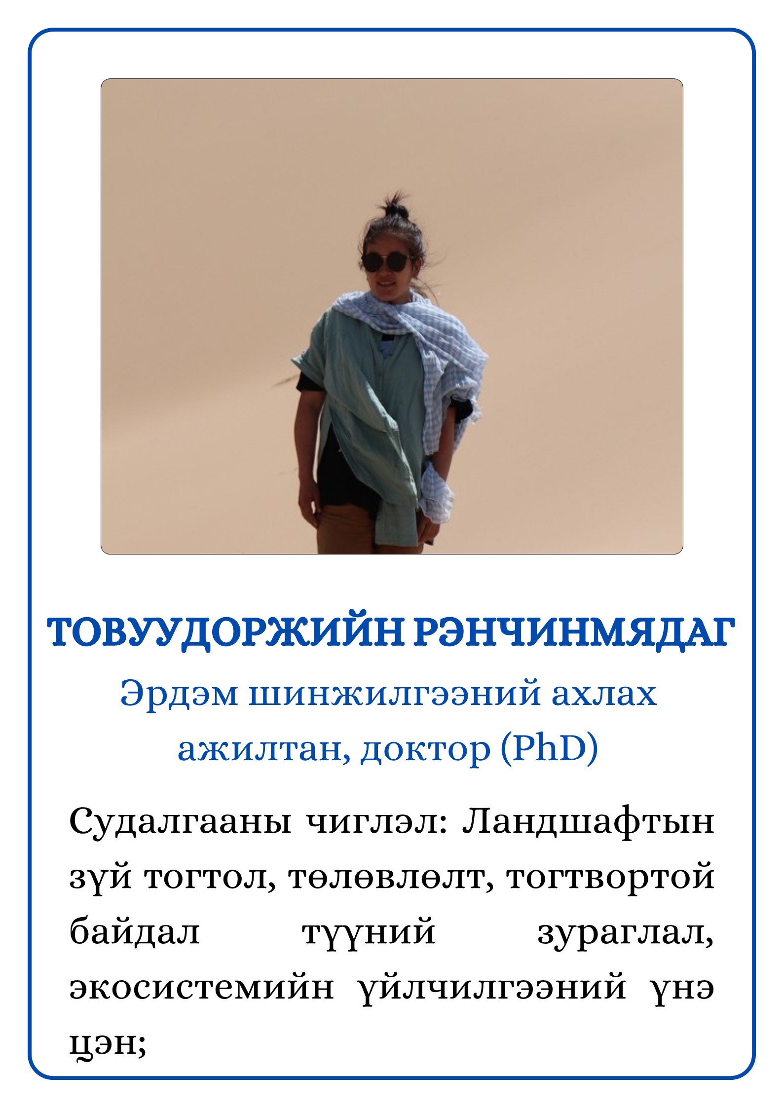
- Ренчинмядаг Т. Монголын хойд хэсгийн ландшафтын бүтэц, ашиглалт, геоэкологийн үнэлгээ (Хараа голын жишээн дээр). ОХУ, 2012
- Мөнхдулам О. Тандан судалгааны өгөгдөл болон машин сургалтын аргуудыг ашиглан Монгол орны газрын нөөцийн чадавхыг үнэлэх нь. Япон, 2023
- Нарангэрэл С. Geographical research on flood hazard estimation and hazard mapping in Mongolia. Япон, 2025
Хүний нөөц
Физик газарзүйн салбар нь 2026 оны байдлаар эрдэм шинжилгээний 9 ажилтантай судалгаа шинжилгээний үйл ажиллагаа явуулж байна. Үүнээс доктор (PhD) зэрэгтэй 2, магистр (MSc) 6, бакалавр (BSc) зэрэгтэй 1 судлаачийн бүрэлдэхүүнтэй ажиллаж байна.
Хэрэгжсэн төсөл, хөтөлбөр
|
1948
|
Үндсэн гүйцэтгэгч Ш.Цэгмид “Комитет наук Монгольской Народной Республики, Кабинет географий. Географического отряда в Хэнтэйскую горную область МНР” сэдэвт ажил
|
|
1949
|
Үндсэн гүйцэтгэгч Ш.Цэгмид. “Комитет наук Монгольской Народной Республики, Кабинет географий. Предварительний отчет географического отряда в Хэнтэйскую горную область в летний период” сэдэвт ажил
|
|
1961
|
ШУА-ийн Байгалийн ухааны хүрээлэнгийн Газарзүйн тасаг “Налайхын их уурхайн олон жилийн цэвдэгт ул хөрс, уулын чулуулгийн төлөв байдал” сэдэвт ажил
|
|
1961
|
Үндсэн гүйцэтгэгч Н.Бадарч. “Туул голын орчим, түүнд нөлөөлөх физик газарзүйн онцлогуудыг судлах шинжилгээний цаг уурын ажиглалт” сэдэвт ажил
|
|
1961
|
Үндсэн гүйцэтгэгч Ж.Цэрэнсодном “Туулын усны горимд нөлөөлөх физик газарзүйн ерөнхий онцлогууд” сэдэвт ажил
|
|
1963
|
Үндсэн гүйцэтгэгч Н.Бадарч, Ш.Цэгмид, Ж.Цэрэнсодном, Д.Юмчмаа “Хэнтий аймагт 1962 онд явуулсан физик газарзүйн судалгаа” сэдэвт ажил
|
|
1975
|
Үндсэн гүйцэтгэгч Р.Ломборинчен. “Институт географий и мерзлотоведения Академии наук Монгольской Народной Республики. Данные пески котловины Байн-нурин хотгор Баинхонгорского аймака” сэдэвт ажил
|
|
1972-1976
|
Үндсэн гүйцэтгэгч З.Санжмятав. “Ойт хээрийн бүсэн дэх физик газарзүйн иж бүрэн суурин судалгааны салбарт усзүйн горимыг 1972-1976 онд судалсан байдал” сэдэвт ажил
|
|
1978
|
Үндсэн гүйцэтгэгч З.Санжмятав. “Ойт хээрийн суурин судалгааны салбарт 1977 онд хийсэн усзүйн судалгаа” сэдэвт ажил
|
|
1978
|
Үндсэн гүйцэтгэгч Б.Авирмид, Ц.Сугар “Булган аймгийн Магсаржав САА-н нутагт Хантайн нурууны Баян голын ай савд явуулсан уур амьсгал, ус зүйн судалгаа” сэдэвт ажил
|
|
1978
|
Үндсэн гүйцэтгэгч Ч.Дамдиндорж, Ц.Сугар, Б.Авирмид “Гурван түрүү станцын орчмын бичил уур амьсгалын онцлог” сэдэвт ажил
|
|
1978
|
Үндсэн гүйцэтгэгч Ц.Мөнхцэцэг “Монгол орны ойт хээрийн бүс дахь физик газарзүйн суурин судалгааны салбарт хийсэн нарны цацрагийн ба дулааны балансын судалгаа” сэдэвт ажил
|
|
1979
|
Үндсэн гүйцэтгэгч Ц.Мөнхцэцэг “Монгол орны нарны цацрагийн ба дулааны балансын судалгаа” сэдэвт ажил
|
|
1979
|
Үндсэн гүйцэтгэгч З.Санжмятав “Монгол орны ойт хээрийн бүсийн физик газарзүйн суурин судалгааны салбарт 1978-1979 онд явуулсан усзүйн судалгаа” сэдэвт ажил
|
|
1979
|
Үндсэн гүйцэтгэгч Б.Авирмид, Ц.Сугар, Ж.Чингарьд, Б.Батхүү “Хантайн нурууны Баян голын ай савд 1978 оны зуны улиралд явуулсан ус, уур амьсгалын судалгаа” сэдэвт ажил.
|
|
1980
|
Үндсэн гүйцэтгэгч Ж.Цэрэнсодном, Ц.Сугар “Хангайн арын тэгш өндөрлөг болон Орхон-Сэлэнгийн бэсрэг уулс дахь нуурт 1976-1980 онуудад явуулсан эрдэм шинжилгээний ажил” сэдэвт ажил
|
|
1980
|
Сэдвийн удирдагч Ж.Нацаг “Хангай-Хэнтийн уулархаг орны хотгор гүдгэрийг бүрэлдүүлэгч орчин үеийн үйл явцыг 1976-1980 онд судалсан эрдэм шинжилгээний ажил” сэдэвт ажил
|
|
1980
|
Үндсэн гүйцэтгэгч Ч. Мөнхцэцэг “Монгол орны ойт хээр, хээрийн бүсийн физик газарзүйн суурин судалгааны салбарт нарны цацрагийн ба дулааны балансын элементүүдийн үндсэн онцлогийг илрүүлэх судалгаа (1976-1980)” сэдэвт ажил
|
|
1980
|
Сэдвийн удирдагч Ж.Нацаг “Төв аймгийн Баян сумын нутагт /L-48-23,24,35,36,48; L-49-25,37/ явуулсан геоморфологийн судалгаа” сэдэвт ажил
|
|
1980
|
Үндсэн гүйцэтгэгч З.Санжмятав “Ойт хээрийн бүсийн суурин судалгааны салбарт усзүйн судалгааг 1972-1980 онд явуулсан эрдэм шинжилгээний ажил” сэдэвт ажил
|
|
1984
|
Сэдвийн удирдагч Ж.Нацаг (Ph.D) “Агаар, сансрын мэдээллийг БНМАУ-ын ландшафтын зураг зохиоход ашиглах аргазүй боловсруулах” дэд сэдэвт ажил
|
|
1985
|
Үндсэн гүйцэтгэгч Тү.Баасан “Монгол орны элсний ургамал” сэдэвт ажил
|
|
1981-1985
|
Сэдвийн удирдагч Ж.Цэрэнсодном (Ph.D) “БНМАУ-ын усны балансын материалыг нэгтгэн дүгнэх” сэдэвт ажил
|
|
1981-1985
|
Сэдвийн удирдагч Ж.Нацаг (Ph.D) “БНМАУ-ын говийн хэсгийн салхин гаралт элсний тархалт, морфологи хэв шинж” дэд сэдэвт ажил
|
|
1984-1985
|
Сэдвийн удирдагч Ж.Нацаг “Агаар сансрын мэдээллийг ашиглан БНМАУ-ын ландшафтын зураг зохиох аргазүй боловсруулах” дэд сэдэвт ажил
|
|
1986
|
Үндсэн гүйцэтгэгч Ж.Цэрэнсодном, З.Санжмятав, О.Цэрэв, Н.Батнасан “Увс нуур болон өрнөдийн нууруудад 1986 оны зун судалгаа шинжилгээ хийсэн экспедицийн ажил” сэдэвт ажил
|
|
1986
|
Үндсэн гүйцэтгэгч Ж.Цэрэнсодном, Ц. Сугар “Умард говийн усны нөөцийг нэгдмэлээр ашиглах, хамгаалах ерөнхий схемийн “нуур” тодорхойлолт” сэдэвт ажил
|
|
1986
|
Сэдвийн удирдагч Н.Лонжид “Архангай, Хөвсгөл аймгийн нутагт 1986 оны намар хийсэн геотермийн хэмжилт” сэдэвт ажил
|
|
1987
|
Үндсэн гүйцэтгэгч Тү.Баасан “Монгол орны салхин гаралт элс” сэдэвт ажил
|
|
1988
|
Сэдвийн удирдагч Б.Авирмид “Сэлэнгэ аймгийн Цагаан толгой САА-н усалгаатай тариалангийн талбайд хийсэн бичил уур амьсгалын 1986-1988 оны эрдэм шинжилгээ судалгаа” сэдэвт ажил
|
|
1988
|
Сэдвийн удирдагч Н.Лонжид. “Хангай-Хөвсгөлийн уулархаг нутагт цэвдэгт үзэгдлийг судалсан тухай урьдчилсан тайлан” сэдэвт ажил
|
|
1988
|
Үндсэн гүйцэтгэгч Д.Даш, Б.Авирмид, О.Сүхбаатар, Э.Авирмэд, Ж.Билэгсайхан, Д.Энхбаяр “Газрын өрхөд аялсан экспедиц” судалгааны ажил
|
|
1988
|
Үндсэн гүйцэтгэгч Б.Авирмид, Э.Авирмэд, Д.Даш, О.Сүхбаатар, П.Цолмон, Д.Энхбаяр “Сөөгтийн агуй экспедиц” судалгааны ажил
|
|
1989
|
Сэдвийн удирдагч Т.Баасан “Ус цэвэрлэгээнд эх орны шүүгүүр материал /элсийг/ ашиглах нь” сэдэвт ажил
|
|
1996-1998
|
Сэдвийн удирдагч Д.Доржготов (Acad.) “Монгол орны газарзүйн системийн нэгдсэн үнэлгээ (Монгол орны ландшафт-экологийн зарим асуудлууд)” сэдэвт ажил
|
|
1999-2001
|
Сэдвийн удирдагч Д.Түвшинжаргал (Ph.D) “Монгол орны газарзүйн бүсчилсэн судалгаа: (Хангай-Хөвсгөлийн уулархаг нутгийн байгалийн нөхцөл)” сэдэвт суурь судалгааны төсөл
|
|
2002-2004
|
Сэдвийн удирдагч Ш.Цэгмид (Acad.) “Хөвсгөлийн баруун хэсгийн физик газарзүйн региональ судалгаа” сэдэвт суурь судалгааны төсөл
|
|
2005-2007
|
Сэдвийн удирдагч Д.Энхтайван (Ph.D) “Туул, Хараа, Ерөө голуудын сав нутгийн ландшафтын бүтэц, өөрчлөлт” сэдэвт суурь судалгааны төсөл
|
|
2008-2010
|
Сэдвийн удирдагч Д.Энхтайван (Ph.D) “Хангайн өмнөх голуудын сав нутгийг зохистой ашиглах газарзүйн үндэслэл” сэдэвт суурь судалгааны төсөл
|
|
2011-2013
|
Сэдвийн удирдагч Д.Доржготов (Acad.) “Монгол орны төв бүсийн нийгэм-эдийн засаг, физик газарзүйн иж бүрэн тодорхойлолт, мэдээллийн сан” сэдэвт суурь судалгааны төсөл
|
|
2014-2016
|
Төслийн удирдагч Д.Энхтайван (Ph.D) “Ландшафтын бүтэц, өөрчлөлт, төлөвлөлт, зохистой бүсчлэл (Монгол орны зүүн бүсийн жишээн дээр)” сэдэвт суурь судалгааны төсөл
|
|
2017-2019
|
Төслийн удирдагч Э.Авирмэд (Ph.D) “Монгол орны байгалийн бүсүүдийн ландшафтын экологийн чадавхийн үнэлгээ” сэдэвт суурь судалгааны төсөл
|
|
2018-2021
|
Төслийн удирдагч Б.Оюунгэрэл (Sc.D) “Хөвсгөл нуурын БЦГ-ын экосистемийн үнэ цэнийг тодорхойлох, экосистемийн үйлчилгээний төлбөр (PES)-ийг тооцох” сэдэвт захиалгат ажил
|
|
2022
|
Төслийн удирдагч С.Нарангэрэл (M.Sc) “Байдраг голын сав нутгийн ландшафт дахь экологийн чадавхийн үнэлгээ ба цаашид зохистой ашиглах хамгаалах үндэслэл” сэдэвт захиалгат ажил
|
|
2022–2024
|
Төслийн удирдагч Т.Рэнчинмядаг (Ph.D) “Экосистемийн үйлчилгээний үнэ цэнийн тооцоонд үндэслэн Буйр, Хяргас нуурын аялал жуулчлалын нөөц, даацыг үнэлэх” захиалгат ажил
|
|
2022–2024
|
Төслийн удирдагч Т.Рэнчинмядаг (Ph.D) “Монгол орны баруун бүсийн ландшафт, геоморфологийн нэгдсэн судалгаа, мэдээллийн сан” суурь судалгааны төсөл
|
|
2024-2025
|
Төслийн удирдагч О.Мөнхдулам (Ph.D) “Статистикийн R программыг ашиглан зайнаас тандан судлалын өгөгдөлд дүн шинжилгээ хийх аргачлал” ШУА-ийн грант төсөл
|
Эрдэм шинжилгээ судалгааны үр дүн
- Цэрэнсодном Ж. Монгол орны нуурын каталог /цэс/ (2000 он)
Тус бүтээл нь 4 бүлэгтэй бөгөөд нэгдүгээр бүлэгт нуурын тухай ерөнхий ойлголт талаар, хоёрдугаар бүлэгт Монгол орны 0.1 км2-аас дээш талбайтай нуурын газарзүйн тархалтын нэгдсэн үзүүлэлтүүдийн талаар, гуравдугаар бүлэгт Монгол орны 0.5 км2-аас дээш талбайтай нууруудын каталог, жагсаалтыг (цэс) оруулсан бол дөрөвдүгээр бүлэгт 0.5 км2-аас дээш талбайтай нуур бүрийн товч тайлбар, газарзүйн тодорхойлолтуудыг тус тус тусгасан байдаг. Энэхүү бүтээлд нууруудыг талбайн хэмжээгээр нь маш жижиг (0.1–1.0 км²), жижиг (1.1–5.0 км²), жижгэвтэр (5.1–10.0 км²), бага (10.1–20.0 км²), багавтар (20.1–50.0 км²), бэсрэг (50.1–100.0 км²), томоохон (100.1–500.0 км²), том (500.1–1000.0 км²), их (1000 км²-аас дээш) гэж ангилан, тухайн үед бүртгэгдээд байсан бүх буюу 3060 нуурыг аймаг тус бүрээр ялган системтэйгээр оруулсан байна.
- Даш Д. Их Нууруудын хотгорын элсэн хуримтлалын ландшафт, байгаль хамгааллын асуудал (2001 он)
Энэхүү бүтээл нь “Нууруудын хотгорын элс бүхий нутгийн байгалийн нөхцөлийн тодорхойлолт”, “Элсэн хуримтлалын ландшафтын төлөв байдал”, “Элсэн хуримтлалын ландшафтын зохистой ашиглалт, хамгаалалтын асуудал” гэсэн 3 бүлэгтэй. Тус бүтээлд Их нууруудын хотгорын ландшафтын үндсэн хэв шинж, тэдгээрийн орон зайн ялгаа, нутаг дэвсгэрийн тархалтын зүй тогтлыг илрүүлэн тодорхойлсон. Мөн тус бүс нутагт тархсан томоохон элсэн хуримтлалуудыг ландшафтын үүднээс нарийвчлан судалж, дотоод бүтэц, ялгааг тогтоон зурагласан бөгөөд элсэн хуримтлал бүхий ландшафтыг зохистой ашиглах, хамгаалах асуудлыг цогц байдлаар авч үзсэн байдаг. Их нууруудын хотгорт өндөр уул, дундаж уул, нам уул, ухаа гүвээт тал, уулс хоорондын тал гэсэн ландшафтын таван ангийн хүрээнд ян сарьдаг, уулын нуга, нугат хээр, уулын хээр, хуурай хээр, цөлжүү хээр, заримдаг цөл, цөлийн ландшафтууд бүслэг байдлаар тархсанаас гадна нуга, хужир, мараа, элсэн хуримтлалын ландшафтууд нэгэн адил тархсан гэж дүгнэжээ.
- Цэгмид Ш. Манай дэлхий: газарзүйн товч лавлах, Евроази тив (2001 он)
Тус бүтээлд Монгол улстай дипломат харилцаа тогтоосон улс орнуудын жагсаалтыг харилцаа тогтоосон огноогоор эмхэтгэн оруулсан байна. Мөн Ази тивийн 47 улс орон, Европ тивийн 44 улс орны байгаль, нийгэм, эдийн засгийн талаар гол мэдээллүүдийг өгч, хоёр тив дээр орших хот суурин, уул нуруу, нам доор газар, арал, хойг, гол мөрөн, нуур, цөл газар, булан, хоолой зэрэг газарзүйн элементүүдийг их багагүй бүгдийг нэрлэн тоочих боломжгүй учир ч дээрх улс орнуудын онцлог бүхий томоохон хот суурин, байгалийн чухал объектуудыг орхигдуулахгүйгээр сонгон тодорхойлсон нь даяаршиж буй дэлхий ертөнцийг танин мэдэхэд ач холбогдолтой, үнэ цэнтэй бүтээл болсон юм. Улс орнуудын хувьд 100 000 дээш хүн амтай хотуудыг сонгон тус лавлах бичигт оруулсан хэдий ч зарим улс орны нийслэл болон томоохон хотууд дээрх тоонд хүрэхгүй, мөн цөөн хүн амтай хэдий ч нэрд гарсан, түүхэн хотуудыг орхигдуулаагүй байна.
- Даш Д. Монгол орны физик газарзүйн судалгааны тойм: Физик газарзүйн салбар 40 жилд (2002 он)
ШУА-ийн Газарзүйн хүрээлэнгийн 40 жилийн ойд зориулан хэвлэгдсэн энэхүү бүтээл нь “Физик газарзүйн салбарын түүхэн замнал”, “Физик газарзүйн салбарт ажиллагсдын тухай”, “Физик газарзүйн салбарын ажилтнуудын бүтээлээс” гэсэн гурван үндсэн бүлгээс бүрдсэн байна. Тус бүтээлд физик газарзүйн салбарын үүсэл, хөгжил, түүхэн замналыг тоймлон өгүүлэхийн зэрэгцээ 1962–2002 оны хугацаанд уг салбараас төрөн гарсан эрдэмтэд, ахмад эрдэм шинжилгээний ажилтнуудын намтар, ажил үйлсийн товчоог багтаасан болно. Мөн тухайн хугацаанд судлаачдын хэрэгжүүлсэн судалгааны үндсэн чиглэл, гүйцэтгэсэн эрдэм шинжилгээний болон үйлдвэрлэл, практикт нэвтрүүлсэн ажлууд, түүнчлэн туурвисан ном, нэг сэдэвт бүтээл, эрдэм шинжилгээний өгүүлэл, илтгэлүүдийн жагсаалтыг эмхэтгэн нэгтгэсэн байдаг. Өөрөөр хэлбэл физик газарзүйн салбарын хөгжил, хүний нөөц, эрдэм шинжилгээний ололт амжилтыг түүхэн талаас нь баримтжуулсан, судалгааны болон лавлагааны чухал ач холбогдолтой бүтээл юм.
- Даш Д. Монгол орны газарзүйн зарим асуудлууд эмхэтгэл (Академич Ш.Цэгмидийн бүтээлээс) (2002 он)
Энэхүү бүтээл нь Монголын газарзүйн шинжлэх ухааныг үндэслэгчдийн нэг, академич Ш.Цэгмидийн амьдрал, эрдэм шинжилгээний ажил, бүтээл туурвилыг цогц байдлаар харуулсан эмхэтгэл юм. Тус эмхэтгэл нь Академич Ш.Цэгмидийн намтар, ажил үйлсийг тоймлон өгүүлж, газарзүйн шинжлэх ухаанд оруулсан хувь нэмэр, физик газарзүйн сурах бичиг болон түүний бүтээлүүдэд өгсөн үнэлгээ зэргийг багтаасан байдаг. Дэд хэсэгт Академичийн туурвисан бүтээлээс түүвэрлэн оруулсан бөгөөд үүнд газарзүйн шинжлэх ухааны хөгжлийн асуудал, геоморфологи, палео-газарзүй, физик газарзүйн мужлал, ландшафт судлал, экологи ба байгаль ашиглалтын чиглэлүүдийг хамарсан бүлгүүд орсон байна. Мөн бүтээлийн төгсгөл хэсэгт академич Ш.Цэгмидийн нэг сэдэвт болон хамтын бүтээлүүд, эрдэм шинжилгээний өгүүллүүдийн дэлгэрэнгүй жагсаалтыг хавсаргасан нь судлаач, оюутнуудад лавлагааны чухал эх сурвалж болж байна. Уг эмхэтгэл нь Монгол орны газарзүйн шинжлэх ухааны хөгжил, академич Ш.Цэгмидийн шинжлэх ухаанд оруулсан үнэтэй хувь нэмрийг системтэйгээр харуулсан, судалгаа болон сургалтын өндөр ач холбогдолтой бүтээл юм.
- Баасан Тү. Монгол орны элс (2003 он)
Монгол орны элс хэмээх энэхүү бүтээлийн нэгдүгээр бүлэгт элсэн тарамцгуудын үүсэл, гадаргын хэлбэр дүрсийн бүрэлдэлт, Монгол орны салхин гаралт (сэвшээгдмэл) элсний элэгдэл-хуримтлалын хотгор гүдгэрийн хэлбэрийн ангилал, салхин гаралт элсний хотгор гүдгэрийн эерэг хэлбэр, салхин гаралт элсний хотгор гүдгэрийн сөрөг хэлбэр, хоёрдугаар бүлэгт салхин гаралт элсний элсний тархалт, талбай, мужлал, говийн хэсгийн салхин гаралт элсний тархалтын район ба дэд районууд, гуравдугаар бүлэгт салхин гаралт элсний зарим шинж чанар, дөрөвдүгээр бүлэгт элсний ургамал, тавдугаар бүлэгт элсний аж ахуйн ач холбогдол, элсний нүүлт хөдөлгөөн, учруулж буй хор хохирол, зургаадугаар бүлэгт хөдөлгөөнт элсийг бэхжүүлэх арга зам (механик, биологийн, химийн) гэсэн агуулгын хүрээнд бичигджээ. Тус бүтээл нь 1991 онд хэвлэгдсэн “Монгол орны элс: Салхин гаралт элс” бүтээлийн нэмж засварласан хоёр дахь хэвлэл бөгөөд тус бүтээл нь говь, цөлийн төдийгүй Монгол орны хэмжээнд хийгдсэн элсний судалгааны цор ганц шинжлэх ухааны эх үүсвэр гэж хэлж болохуйц сурвалж бүтээл юм.
- Цэгмид Ш. Газарзүйн шинжлэх ухаан Монголд (2003 он)
ШУА-ийн Газарзүйн хүрээлэн (тухайн үеийн нэрээр)-ийн 40 жилийн ойд зориулан хэвлэгдсэн тус бүтээл нь 1924 онд судар бичгийн хүрээлэн байгуулагдсан тэр цагаас эхлэн Монгол оронд хийгдсэн гадаадын судлаачдын ялангуяа, ЗХУ-ын эрдэмтдийн явуулсан судалгаа, тэдгээрийн шинжлэх ухааны ач холбогдлыг онцлон авч үзэхийн зэрэгцээ, энэ хооронд үндэсний газарзүйчдийн бүрэлдсэн үе буюу Монгол улсад орчин цагийн шинжлэх ухаан үндэс суурийг тавьсан газарзүйч эрдэмтдийн судалгааны чиглэл, онцлох үр дүнгүүд, туурвисан бүтээлүүд тэдгээрийн шинжлэх ухааны агуулгыг эмхэтгэн оруулсан байдаг. Уг бүтээл нь Физик газарзүйн салбарын судалгаа, нийгэм-эдийн засгийн газарзүйн салбарын судалгаа, бусад салбарын судалгаа гэсэн бүлгийн хүрээнд Монгол оронд хийгдсэн бүхий л судалгаа, судлаачдын талаар товч, тодорхой мэдээллийг агуулна. Иймд уг бүтээл нь Монголын газарзүйн шинжлэх ухааны үүсэл хөгжил, судалгааны уламжлал, эрдэмтдийн хувь нэмрийг нэгтгэн харуулсан, судалгааны болон лавлагааны өндөр ач холбогдолтой эх сурвалж юм.
- Baasan Tudev. Aeolian sands of Mongolia (2004 он)
Энэхүү бүтээл нь 2003 онд хэвлэгдсэн “Монгол орны элс” номын орчуулгын хувилбар бөгөөд орчуулгыг Цолмонгийн Сэлэнгэ хийжээ. Зохиогч нэгэн ярилцлагадаа “… Америкийн судлаачид 1646–2012 оны хооронд буюу сүүлийн 360 гаруй жилийн хугацаанд элс болон салхины үйлчлэлээр үүссэн хуримтлалын талаар бичигдсэн олон тооны бүтээлүүдийг харьцуулан судалж, чанарын шалгуур тогтоосон байна. Уг шалгаруулалтад элсийг зөв тодорхойлсон эсэх, түүний химийн болон физик найрлагыг оновчтой тайлбарласан байдал, элсний сөрөг нөлөө (хор хөнөөл) болон эерэг тал (ашиг тус)-ыг иж бүрнээр авч үзсэн эсэх зэрэг үндсэн дөрвөн шалгуурыг хэрэглэсэн бөгөөд эдгээрийг бүрэн хангасан бүтээлийг шалгаруулахад миний ном шалгарсан юм билээ...” гэж өөрийн бүтээлийн талаар дурсан ярьсан байдаг. Тус бүтээл нь элсний үүсэл, шинж чанар, нөлөөллийг шинжлэх ухааны үндэслэлтэйгээр тайлбарласан, олон улсын түвшинд үнэлэгдсэн үнэ цэнтэй бүтээл юм.
- Оюунгэрэл Б. Монгол улсын тусгай хамгаалалттай газар нутаг (2004 он)
Тус бүтээл нь агуулгын хувьд тусгай хамгаалалттай газар нутгийн тухай тодорхойлолт, тусгай хамгаалалттай газар нутгийн олон улсын ангилал, монгол улсын тусгай хамгаалалттай газар нутгийн ангилал, газар нутгийг дархлан хамгаалж ирсэн түүхийн тойм, тусгай хамгаалалттай газар нутгийг судалсан байдал, тусгай хамгаалалттай газар нутгийн орон зайн сүлжээ үүсэх онол, арга зүйн асуудлууд, тусгай хамгаалалттай газар нутагт явуулах эрдэм шинжилгээ-судалгааны ажил, тусгай хамгаалалттай газарт явуулах аялал жуулчлал, тусгай хамгаалалттай газар нутгийн зохистой сүлжээний өнөөгийн байдал, хэтийн төлөв, тусгай хамгаалалттай газар нутгийн олон улсын хамтын ажиллагаа, тусгай хамгаалалттай газруудын товч тодорхойлолт, дархан цаазат газрууд, байгалийн цогцолборт газрууд, байгалийн нөөц газрууд, дурсгалт газрууд, хил дамнасан тусгай хамгаалалттай газрууд, дэлхийн өвд орсон газрууд, олон улсын ач холбогдол бүхий ус намгархаг газар, ялангуяа усны шувууд олноор амьдардаг орчны тухай "Рамсарын конвенцод орсон газрууд, шинээр тусгай хамгаалалтад авах газрууд гэсэн бүлгүүдийн хүрээнд бичигдсэн.
- Баасан Тү. Чингисийн далан гэж юу вэ? (2006 он)
Ховд, Өмнөговь, Хэнтий, Дорнод, Сүхбаатар, Төв, Өвөрхангай аймгуудын нутгаар олон арван километр урт үргэлжилсэн эртний суваг, далан, хэрмийн ул мөр, үлдэц одоо болтол тод хадгалагдан, физик газарзүйн болон байрзүйн зурагт "Чингисийн далан” гэж тэмдэглэгдсээр иржээ. Эртний тэдгээр байгууламжийг нутгийн ардууд Сартуулын суваг, Сарагтайн шуудуу, хэрмэн зам, Чингисийн хэрэм, гүнжийн зам, Илжгэн чихт хааны хэрэм гэх зэргээр нэрлэж гарал үүсэлтэй нь янз бүрийн домог ярьдаг боловч чухам аль үед, ямар зорилгоор, хэн хийсэн, яагаад орхигдож мартагдсаныг тусгайлан шалгаж нэгэн мөр болгон тодорхой бичсэн зүйлгүй шахам, битүүлэг өнөө хүрчээ. Иймд энэхүү номоор "Чингисийн далан" гэх байгууламжуудын газарзүйн байршилыг нарийвчлан тогтоож, чухам аль үед, ямар зорилгоор, хэн бүтээсэн, яагаад орхигдож мартагдах болсоныг, тус байгууламжийг хэсэгчлэн сэргээж аялал жуулчлал, тариалангийн усалгаа, цөлжилттэй тэмцэх зэрэгт ашиглах боломжтой эсэхийг, олон улсын хамтын ажиллагаагаар, олон талаас нь иж бүрнээр судлан тогтоож хариулт өгөхийг уриалан дуудсан бүтээл юм.
- Баасан Тү. Баянхонгор аймгийн газар усны нэрийн бага нэвтэрхий толь (2006 он)
Баянхонгор аймгийн газар усны нэрийн бага нэвтэрхий толь бүтээлд байгаль дэлхийн үзэсгэлэн бүхэн бүрдсэн Баянхонгор нутгийн газарзүйн оршилт, нутаг дэвсгэрийн товч тодорхойлолт, Баянхонгор аймгийн газар усны нэр зүй, аймгийн газар усны нэрийн бага толь, аймаг байгуулагдахаас өмнөх үеийн нийгмийн байдлын товч түүх, аймаг байгуулагдсан түүх зэрэг Баянхонгор аймгийн нутаг дэвсгэрийн дунд масштабын байрзүйн зурагт тусгагдсан уур нуруу, гол мөрөн, булаг шанд, нуур-цөөрөм, ай сав, хөндий-хоолой, ой мод, агуй, говь талууд зэрэг байгалийн элементүүдийг болон хүний хүчин зүйлээр бий болсон эртний хотуудын туурь, балгас, булш хэрэгсүүр, хот суурин гэх мэт газарзүйн объектуудыг хамруулан газар усны 3000 шахам нэрийг жагсаан бичжээ.
- Баасан Тү. Монголын эрхэм дээд Богд уулс (2008 он)
Монгол эх орныхоо хамгийн эрхэм Богд нэртэй уулсын тухай мэдэх хүсэлтэй, уулын спорт, аялал жуулчлалд дуртай хэн бүхэнд зориулсан тус номонд манай улсын хэмжээнд байгаа бүх Богд нэртэй уулсыг өндрийн хэмжээгээр нь ангилж, амьтан, ургамлын аймаг, уртраг, өргөрөг, фото зураг болон бусад мэдээллүүдээр баяжуулж өгсөн байна. Эл номонд Монгол улсын нутаг дэвсгэрт орших "Богд" өргөмжит нэртэй 89 уулнаас гадна, мөн "Богд" өргөмжит нэр бүхий цав толгод, даваа хөтөл, хөндий хоолой, гол горхи, булаг шанд зэрэг нийт 100 гаруй тооны уул усыг багтаан бичжээ. Богд нэртэй уул усны "Нэвтэрхий толь" гэж нэрлэж болох энэ суурь бүтээлд Богд уулсын оргилын оройн цэгийг газарзүйн болон тэгш өнцөгт солбилцолоор нарийвчлан тодорхойлж, үнэмлэхүй ба харьцангуй өндрийг нягтлан шалгаж, GPS-ийн хэмжилтээр баталгаажуулсны зэрэгцээ Богд уул тус бүрийн сансрын, байрзүйн, дүүргийн геологийн зураг, их төлөв зохиогчийн өөрийнх нь авсан олон сайхан фото болон гар зургаар баяжуулсан нь илүү сонирхолтой, өргөн олон уншигчдын оюун санааг татахуйц бүтээл юм.
- Авирмэд Э. Монгол орны агуй (2008 он)
Тус бүтээлийн редактораар Академич Ш.Цэгмид, П.Цолмон нар ажилласан бөгөөд агуулгын хувьд агуйн судалгааны тойм, Монгол орны агуйн гарал үүсэл, Монгол орны агуйн ангилал, Монгол орны агуйн бүтэц, Монгол орны агуйн газарзүйн тархалт, Монгол орны нөөцийг ашиглах, хамгаалах асуудал гэсэн бүлгүүдтэй. Судлаач уг бүтээлдээ Монгол оронд хийсэн агуйн судалгааны тойм, агуй үүсэн бий болоход нөлөөлөх үндсэн хүчин зүйл болох геологийн тогтоц, эрдэс чулуулгийн тархалтын зүй тогтол, уур амьсгалын нөхцөл, байгалийн бусад хүчин зүйлс нарийвчлан судалж, газрын доорх хөндийн ангилалд тулгуурлан гарал үүслээр нь карстын, элэгдэл эвдрэлийн, галт уулын гаралтай агуй гэж ангилан, агуйг үүсгэдэг хурдас чулуулаг, агуйн тархалтын онцлогтой уялдуулан 6 район, 5 дэд район бүхий агуйн тархалтын мужлалт үйлдэн томоохон агуйнуудыг тодорхойлон бичсэнээс гадна агуйн нөөц баялаг, агуйн рекреацийн нөөцийн үнэлгээг хийж, агуйг хамгаалах, агуйн аялал жуулчлалын хөгжүүлэх асуудлыг тусгажээ.
- Баасан Тү. Монголын говь (2010 он)
Манай орны говь, говийн бүсийн байгалийн ерөнхий төрх, Монгол орны говь, цөлийн хэв шинж, Манай оронд хэдэн говь бий тухай, говиудыг аймгаар нь ялгасан жагсаалт, говиудын газарзүйн товч тодорхойлолт, цөлжилтийг үнэлэх, гандуу нутгийг хамгаалах аргууд зэрэг эх орны маана үзэсгэлэнт сайхан говь нутгийн талаарх дэлгэрэнгүй бүтээл юм. Монгол улсын хэмжээнд орших бүх говиудыг жагсаан нэг бүрчлэн аль аймгийн аль суманд орших зэргээр газарзүйн байршлаар нь хийгээд аймаг тус бүрт оршин байх говь нэртэй газруудыг тогтоон судалж улмаар Дундговь аймагт 94 говь, Дорноговь аймагт 93 говь, Сүхбаатар аймагт 70 говь, Дорнод аймагт 29 говь, ГовьАлтай аймагт 21 говь, Ховд аймагт 8 говь, Хэнтий аймагт 8 говь, Баянхонгор аймагт 5 говь, Баян-Өлгий аймагт 5 говь, Увс аймагт 3 говь, Өвөрхангай аймагт 3 говь, Төв аймагт 2 говь байна гээд нийтдээ Монгол орны хэмжээнд 341 говийг тэмдэглэн газарзүй, байгаль цаг уурын хувьд ямар ямар бүсэд байрлах болон говийн хэмжээ, ургах ургамал, амьдрах араатан жигүүртэнг хүртэл танилцуулсан бүтээл билээ.
- Оюунгэрэл Б. Особо охраняемые природные территорий Монголии (2011 он)
Тус номонд Монгол улсын тусгай хамгаалалттай газар нутгийн үндсэн асуудлууд, тухайлбал тусгай хамгаалалттай газар нутгийн ангилал, ангиллыг оновчтой болгох, өнөөгийн байдал, хөгжлийн хэтийн төлөвийг тусгасан байдаг. Монгол улсын Засгийн газраас байгаль хамгаалах, тусгай хамгаалалттай газар нутгийн сүлжээг хөгжүүлэх чиглэлийг тогтоож, нийт нутаг дэвсгэрийн 30 хүртэлх хувийг тусгай хамгаалалтад авах зорилт тавьсан бөгөөд 2011 оны байдлаар улсын хэмжээнд 25.3 сая га буюу Монгол улсын нийт нутаг дэвсгэрийн 16.05 хувийг эзэлдэг 73 тусгай хамгаалалттай газар нутгийн хамгаалалтанд авсан байна. Хил дамнасан тусгай хамгаалалттай газар нутгийг бий болгоход онцгой анхаарал хандуулж Оросын Холбооны улс, Бүгд Найрамдах Хятад Ард улс, Монгол улсын хил дамнасан олон улсын “Монгол Дагуурын” дархан цаазат газар байгуулсан мөн "Увс нуурын сав газрын ТХГН"-ыг дэлхийн өвд бүртгүүлсэн. Цаашид ОХУ-тай хамтран 5 тусгай хамгаалалттай газар, Алтайд дөрвөн талт (Орос, Монгол, Казахстан, Хятад) нэг, БНХАУ-тай хамтран 5 тусгай хамгаалалттай газар нутгийг нэмж байгуулахаар төлөвлөсөн талаар тус бүтээл дурдсан байна.
- Авирмэд Э. Талын агуй (2011 он)
Тус бүтээл нь 6 бүлэгтэй бөгөөд нэгдүгээр бүлэгт Талын агуйн судалгааны түүх, хоёрдугаар бүлэгт Талын агуйн үүсэл хөгжил, гуравдугаар бүлэгт Талын агуйн ландшафт, дөрөвдүгээр бүлэгт Талын агуйн рекреацын нөөц, тавдугаар бүлэгт Талын агуйн хамгаалалт, бэхэлгээ, зөвлөмж, журам, зургаадугаар бүлэгт Талын агуй орчмын байгалийн үзэсгэлэнт газруудын талаар өгүүлнэ. Бүтээлийн зарим дүгнэлтүүдээс товч дурдвал Талын агуй нь гаднаас орж ирсэн хур бороо, хаврын шар усны үерийн ус агуйд нэвтэрч жилд 21 см-ээр нэмэгдэж улмаар 6.5 жилийн дараа агуйн амны хонхор усаар дүүрнэ. Агуйн тааз, хана зэрэг чулуулгийн завсраар ус орж хөлдсөөр ан цавыг улам нэмэгдүүлж энэ нь улмаар агуйн таазыг цөмрөл нуралд хүргэх аюул нэмэгдсээр байна гэж дүгнээд агуйн хананд тулгуур баганаар бэхлэх, гаднаас орж ирэх үерийн усыг тогтоох зорилгоор хамгаалалтын далан барих зэрэг зөвлөмжийг өгсөн бөгөөд тус бүтээл хэвлэгдсэнээс даруй арав орчим жилийн дараа судлаач талын агуйг сэргээн засварлаж ажлын хэсгийг ахлан хамгаалалтын далан, тулгуур багана, гадна тохижилтын ажил зэргийг хийж гүйцэтгэсэн нь шинжлэх ухааны суурь судалгаа практик үр дүнд хүрсэн нэгэн тод жишээ юм.
- Авирмэд Э. Агуй (2013 он)
Тус бүтээлийг О.Төмөртогоо, Э.Батсайхан нар редакторласан бөгөөд бүтээл нь агуйн хурдас чулуулгийн судалгааны чиглэлээр зохиогчдын явуулсан олон жилийн судалгааны ажлын дүнг багтаасан нийт найман бүлгээс бүрдэх томоохон бүтээл юм. Нэгдүгээрт бүлэгт агуйн тухай ойлголт, хоёрдугаар бүлэгт Агуйн үүсэл ба хөгжил, гуравдугаар бүлэгт Агуйн бүрэлдэл, дөрөвдүгээр бүлэгт Агуйн хурдас, тавдугаар бүлэгт Агуйн ангилал, зургаадугаар бүлэгт Агуйн газарзүйн мужлалт, Долоодугаар бүлэгт газрын доорх ландшафт, наймдугаар бүтэг Агуйн ач холбогдлын тухай дэлгэрэнгүй тусгасан байна. Зохиогч агуй болон түүний доторх бүрэлдлийн тухай сүүлийн 20 гаруй жилийн хугацаанд цуглуулсан өөрийн агуйн судалгааны материалд тулгуурлан энэхүү номыг бичжээ. Зохиогч номондоо Монгол орны агуйд бүрэлдэн бий болсон агуйн бүрэлдэлүүдийг дэлхийн зарим агуйд бүрэлдэн бий болсон агуйн бүрэлдэлтэй харьцуулан судалж унжуу, ургуу бана, агуйн шүр, хөшигөн бана, гахайн махан бана, арганит, агуйн эрдэнэ шиш, гипсэн цэцэг, бамбай, тавцан чулуу, мушгиас, чулуун цэцэг, чулуун хүрхрээ зэрэг 30-аад хурдас чулуулгийг олж бүртгэн оруулжээ.
- Авирмэд Э. Монголын агуй (2020)
Бүтээлийн ерөнхий редакторааар Д.Доржнамжаа, Э.Батсайхан нар ажиллажээ. Судлаач сүүлийн 40 орчим жилийн хугацаанд өөрийн хийсэн агуйн судалгааны материалд тулгуурлан бичсэн бүтээл юм. Олон улсын агуй судлалын холбоотой хамтран агуйн судалгааны олон экспедицийг зохион байгуулсаны дүнд өнөөдрийн байдлаар 335 агуйг судалжээ. “Монголын агуй” ном нь үндсэн долоон бүлэг 35 дэд бүлгээс бүрдэнэ. Номын нэгдүгээр бүлэгт олон улсын агуйн судалгааны өнөөгийн түвшин болон Монгол оронд хийсэн агуйн судалгааны тоймыг нэгтгэн оруулсан, хоёрдугаар бүлэгт Монгол орны агуй үүсэн бий болоход гол хүчин зүйл болох геологийн тогтоц, эрдэс чулуулгийн тархалтын зүй тогтол, уур амьсгалын нөхцөл, байгалийн бусад хүчин зүйлийг нэлээд дэлгэрэнгүй оруулсан, гуравдугаар бүлэгт Монгол орны агуйн ландшафт, агуйн морфологи, уур амьсгал, ус зүй, шим ертөнцийн тухай, дөрөвдүгээр бүлэгт Монгол орны агуйн бүрэлдэлүүд, агуйд дусаж үүссэн болон ургаж үүссэн бүрэлдэл, ауйн мөсөн болон кристалл бүрэлдэл, агуй гарлын хурдас, агуйн хурдасны насны тухай дэлгэрэнгүй, тавдугаар бүлэгт Газрын доорх хөндийн ангилалд тулгуурлан Монгол орны байгалийн гаралтай агуйнуудыг гарал үүслээр нь карстын, элэгдэл эвдрэлийн, суффозын, галт уулын гаралтай агуй, хэв шинжээр нь босоо, хэвтээ, налуу, хосолмол гэсэн агуйн ангилал, зургаадугаар бүлэгт Монгол орны агуйн газарзүйн тархалтын онцлогтой уялдуулан агуйн мужлалыг боловсруулан 12 муж зургааны дэд мужийг ялган тогтоож, томоохон агуйнуудын тодорхойлолтыг оруулсан бол долоодугаар бүлэгт Монгол орны агуйн нөөц баялаг агуйн рекреацийн нөөцийн үнэлгээг хийж агуйг хамгаалах асуудлыг голлон оруулжээ.
- Авирмэд, Э. Оюунгэрэл Б, Рэнчинмядаг Т, Мөнхдулам О, Баянжаргал Б, Батням Ц, Даваагатан Т, Пүрэвсүрэн М. Монгол орны ландшафтын экологийн чадавх (2020)
Тус бүтээлийн ерөнхий редактораар доктор Э.Авирмэд ажилласан бөгөөд нэгдүгээр бүлэгт Экологийн хүчин зүйл, хоёрдугаар бүлэгт Экологи-геоморфологийн чадавхын үнэлгээ, гуравдугаар бүлэгт Чулуун мандлын гадаргын хэсгийн экологи-геологийн чадавхын үнэлгээ, дөрөвдүгээр бүлэгт Уур амьсгалын экологийн чадавхын үнэлгээ, тавдугаар бүлэгт Ландшафтын усан хангамжийн чадавхын үнэлгээ, зургаадугаар бүлэгт Хөрсний экологийн чадавхын үнэлгээ, долоодугаар бүлэгт Ургамлын экологийн чадавхын үнэлгээ, наймдугаар бүлэгт Ландшафтын тогтвортой байдлын чадавхын үнэлгээ, есдүгээр бүлэгт Ландшафтын экологи-эдийн засгийн чадавхын үнэлгээ, аравдугаар бүлэгт Ландшафтын экологийн чадавхын нэгдсэн үнэлгээ, Арван нэгдүгээр бүлэгт Монгол орны байгалийн бүс, бүслүүрийн тодорхойлолт гэсэн нийт 11 бүлэг, 94 дэд бүлэг, 157 зураг, 125 хүснэгт бүхий 402 хуудастай бүтээл юм.
- Рэнчинмядаг Т, Батням Ц, Мөнхдулам О, Даваагатан Т, Нарангэрэл С, Одбаатар Э, Баянжаргал Б, Пүрэвсүрэн М, Золзаяа Х. Монгол орны газарзүйн гайхамшиг (2022 он)
Газарзүй, геоэкологийн хүрээлэнгийн Физик газарзүйн салбарын эрдмийн хамт олон Монгол оронд орчин цагийн шинжлэх ухаан үүсэж хөгжсөний 100 жилийн ойг тохиолдуулан газарзүй сонирхогч сурагч, оюутан, багш нар болон өргөн олон уншигчдад зориулсан “Монгол орны газарзүйн гайхамшиг” нэртэй танин мэдэхүйн товхимлыг хэвлүүлэн гаргасан. Энэхүү товхимол нь нийт 60 хуудас, 3 бүлэг, 40 гаруй зураг, дүрслэл бүхий физик газарзүйн суурь ойлголтуудыг төлөвшүүлэх, тухайн чиглэлийн мэдлэгийг өргөжүүлэхэд чиглэсэн нэмэлт тайлбар, сонирхолтой баримт, шинэлэг санаа, тоон мэдээллийг багтаасан бүтээл юм. Бүлэг тус бүрийн агуулгыг асуулт-тайлбарын хэлбэрээр зохион байгуулж, ойлголтыг илүү тодорхой, хүртээмжтэй болгох үүднээс холбогдох зураг, схем, газрын зургийг хавсаргасан нь уншигчдад сэдвийг хялбар ойлгоход чухал ач холбогдолтой.
- Нарангэрэл С, Рэнчинмядаг Т, Мөнхдулам О, Одбаатар Э, Батням Ц, Баянжаргал Б, Даваагатан Т, Пүрэвсүрэн М, Золзаяа Х. Физик газарзүй орчин судлалын салбар-60 жил, түүхэн товчоон (2022 он)
Энэхүү эмхэтгэл бүтээл нь 2022 онд ШУА-ийн Газарзүй, геоэкологийн хүрээлэнгийн 60, 25 жилийн ой, нэрт газарзүйч, төрийн шагналт, академич Ш.Цэгмидийн мэндэлсний 100 жилийн ойд зориулан тухайн салбарын түүх, судалгааны товч үр дүнг харуулсан бүтээл юм. Уг бүтээл нь 4 бүлэг 2 хавсралт бүхий 304 хуудаснаас бүтнэ. Нэгдүгээр бүлэгт Монголын газарзүйн шинжлэх ухааныг үндэслэгч, нэрт газарзүйч, төрийн шагналт, академич Шагдарын Цэгмидийн амьдрал үйл хэрэг, хоёрдугаар бүлэгт Физик газазүй, орчин судлалын салбарын судалгааны түүх, гуравдугаар бүлэгт Физик газарзүй, орчин судлалын салбарын эрдэмтэн, судлаачид, дөрөвдүгээр бүлэгт Физик газарзүй, орчин судлалын салбарын эрдэм шинжилгээний бүтээл, Хавсралт 1-д Түүхэн агшин гэрэл зурагт, Хавсралт 2-д Салбараас төрөн гарсан судлаачдын талаарх товч хүснэгтэн мэдээллийг тус тус тусгасан байна.
- Мөнхдулам О, Даваагатан Т, Одбаатар Э. Статистикийн R программыг ашиглан зайнаас тандан судлалын өгөгдөлд дүн шинжилгээ хийх аргачлал (2025 он)
Энэхүү бүтээл нь орчин үеийн өгөгдөлд суурилсан шинжилгээний арга зүйг зайнаас тандан судлалын өгөгдөлд ашиглах, улмаар R программчлалын орчинд орон зайн өгөгдлийг боловсруулах, дүн шинжилгээ хийх, үр дүнг дүрслэх үндсэн зарчим, аргачлалуудыг системтэйгээр тайлбарласан байна. Ном нь оршил болон гурван үндсэн бүлгээс бүрдэх бөгөөд эхний бүлэгт R программын хэрэглээ, орон зайн өгөгдлийн төрөл, тандан судалгааны өгөгдлийн эх сурвалжийг танилцуулсан. Хоёрдугаар бүлэгт вектор өгөгдөл боловсруулах арга зүй, гуравдугаар бүлэгт растер өгөгдлийн боловсруулалт, дүн шинжилгээ, загварчлалын аргуудыг дэлгэрэнгүй авч үзсэн байна. Ялангуяа орон зайн дүн шинжилгээ, машин сургалтын арга (жишээ нь Random Forest), хугацаан цуваа, PCA зэрэг орчин үеийн статистик аргуудыг R программыг ашиглан хэрхэн тооцох жишээг кодыг Монгол орны өгөгдөл дээр тулгуурлан үзүүлсэн байдаг. Энэхүү бүтээл нь оюутан, судлаач, багш, бодлого боловсруулагч болон өгөгдлийн шинжилгээний мэргэжилтнүүдэд зориулсан бөгөөд зайнаас тандан судлалын өгөгдлийг боловсруулах суурь мэдлэг, практик чадварыг олгоход чиглэсэн бөгөөд орон зайн өгөгдлийн шинжилгээ, хүрээлэн буй орчны судалгаа, шийдвэр гаргалтад өгөгдөл ашиглах чадавхыг бэхжүүлэхэд чухал ач холбогдолтой бүтээл юм.
Олон улсын хянан магадалгаа хийгддэг мэргэжлийн сэтгүүлд хэвлүүлсэн эрдэм шинжилгээний өгүүллийн жагсаалт (2020-2025)
- Munkhtur, P., Oostdijk, M., & Cook, D. (2025). Habitat degradation and quality assessment of Khyargas Lake, Western Mongolia and adjacent terrestrial and freshwater areas. Journal of Environmental Management, 394, 127325. https://doi.org/10.1016/j.jenvman.2025.127325
- Enkhjargal, O., Lamchin, M., You, X, Y., Chambers, J., Tuyagerel, D., Tovuudor,j R., Enkhtuya, N. Carcinogenic and non-carcinogenic risk assessment of heavy metals in PM2. 5 air pollutant in Ulaanbaatar, Mongolia during the wintertime. Air Quality, Atmosphere & Health, Volume 18 (2), 31 January 2025, 615-629. https://link.springer.com/article/10.1007/s11869-025-01705-8
- Wang, R., Guo, X., Liu, C., Zhang, L., Wang, Z., Tseveengerel, B., ... & Han, C. (2025). In situ high-resolution characterization of phosphorus–iron–sulfur dynamics across the sediment–water interface of a typical cold-arid lake (Ugii Lake, Mongolia). Environmental Science: Processes & Impacts, 27(8), 2288-2297
- Otgonbayar, M., Tuyagerel, D., Tovuudorj, R., & Enkhjargal, O. (2025). Extending NDVI time series in Mongolia using spatial correlation analysis between AVHRR-GIMMS and MODIS TERRA data. Mongolian Journal of Geography and Geoecology, 62(46), 174–181. https://doi.org/10.5564/mjgg.v62i46.4133
- Otgonbayar, M., Gendenjav, N., Tovuudorj, R., & Tuyagerel, D. (2025). Distribution, characteristics, and morphogenetic types of relief: A case study of Myangad soum, Khovd province. Mongolian Journal of Geography and Geoecology, 62(46), 70–80. https://doi.org/10.5564/mjgg.v62i46.4238
- Otgonbayar, M., Tovuudorj, R., Tseveengerel, B., Munkhtur, P., & Tsedevdorj, S. (2025). Methodology for landscape mapping at the regional scale: A case study of the western region of Mongolia. Mongolian Journal of Geography and Geoecology, 62(46), 146–156.* https://doi.org/10.5564/mjgg.v62i46.4278
- Neupane, B., Orgil, A., Otgonbayar, M., Zamba, B., Damdin-Od, D., & Thakuri, S. (2025). Adapting to the new normal: Challenges and strategies for landlocked Asian mountainous countries in the face of extreme climate events. Mongolian Journal of Geography and Geoecology, 62(46), 125–131. https://doi.org/10.5564/mjgg.v62i46.4123
- Tuyagerel, D., Otgonbayar, M., & Tovuudorj, R. (2025). Cultural ecosystem service value of Khyargas Lake. Mongolian Journal of Geography and Geoecology, 62(46), 91–100. https://doi.org/10.5564/mjgg.v62i46.4251
- Munkhtur, P., Tseveengerel, B., Bumtsend, B., & Enkhjargal, O. (2025). Seasonal water yield modelling of the Baidrag River Basin. Mongolian Journal of Geography and Geoecology, 62(46), 189–199. https://doi.org/10.5564/mjgg.v62i46.4138
- Gantsetseg, U., Batdelger, O., Serdyanjiv, N., Tseveengerel, B., Enkhjargal, O., Munkhtur, P., Tuyagerel, D., Han, C., Liu, C., & Wang, Z. (2025). Spatiotemporal assessment of water quality and geochemical evolution of Ugii Lake. Mongolian Journal of Geography and Geoecology, 62(46), 213–221. https://doi.org/10.5564/mjgg.v62i46.4151
- Bumtsend, B., Munkhtur, P., & Enkhjargal, O. (2025). Geomorphometric delineation and subdivision of the Altai mountains using DEM-based analysis. Proceedings of the Mongolian Academy of Sciences, 65(02), 1–12. https://doi.org/10.5564/pmas.v65i02.4389
- Tseveengerel, B., Munkhtur, P., & Tovuudorj, R. (2025). Topoclimatic drivers of land cover change in the Mongol Altai Mountains using random forest and extreme gradient boosting algorithms. Mongolian Journal of Geography and Geoecology, 62(46), 139–149. https://doi.org/10.5564/mjgg.v62i46.4126
- Munkhtur, P., Tseveengerel, B., & Bumtsend, B. (2025). Water accounting: A case study in the Buir Lake–Khalkh River Basin. Proceedings of the Mongolian Academy of Sciences, 29–51. https://doi.org/10.5564/pmas.v65i01.4204
- Cai, T., Chang, C., Zhao, Y., Wang, X., Yang, J., Dou, P., Otgonbayar, M., Zhang, G., Zeng, Y., & Wang, J. (2024). Within-season estimates of 10 m aboveground biomass based on Landsat, Sentinel-2 and PlanetScope data. Scientific Data, 11, 1276. https://doi.org/10.1038/s41597-024-04120-3
- Liu, W., Wang, J., Hu, Y., Ma, T., Otgonbayar, M., Li, C., … & Yang, J. (2024). Mapping shrub biomass at 10 m resolution by integrating field measurements, unmanned aerial vehicles, and multi-source satellite observations. Remote Sensing, 16(16), 3095. https://doi.org/10.3390/rs16163095
- Chang, C., Wang, J., Zhao, Y., Cai, T., Yang, J., Zhang, G., Wu, X., Otgonbayar, M., Xiao, X., Xin, X., & Zhang, Y. (2024). A 10-m annual grazing intensity dataset in 2015–2021 for the largest temperate meadow steppe in China. Scientific Data, 11(1), 181. https://doi.org/10.1038/41597-03017-5
- Zhu, W., Zhang, Z., Zhang, H., & Tovuudorj, R. (2024). Integrating spatial patterns and driving factors of cultural ecosystem services into territorial spatial governance: A case study of the Horqin Sandy Land with multi-ethnic settlements. Habitat International, 148, 103093. https://doi.org/10.1016/j.habitatint.2024.103093
- Odbaatar, E., Lamchin, M., You, X.-Y., Chambers, J., Tuyagerel, D., Tovuudorj, R., Khurelsukh, Z., Sarangerel, E., & Enkhtuya, N. (2024). Correction: Carcinogenic and non-carcinogenic risk assessment of heavy metals in PM2.5 air pollutant in Ulaanbaatar, Mongolia during the wintertime. Air Quality, Atmosphere & Health. https://doi.org/10.1007/s11869-024-01678-0
- Amarsaikhan, E., Erdenebaatar, N., Damdinsuren, D., Otgonbayar, M., & Bayaraa, B. (2023). Estimation and mapping of pasture biomass in Mongolia using machine learning methods. Geocarto International, 38(1), 2195824. https://doi.org/10.1080/10106049.2023.2195824
- Otgonbayar, M., Tseveddorj, S., Bumtsend, B., Enkhjargal, O., & Tovuudorj, R. (2023). Spatial relationships between topographic variables and their interactions with natural and climatic zonalization in Mongolia. European Modern Studies Journal, 7(5), 106–119. https://doi.org/10.59573/emsj.7(5).2023.1
- Enkhjargal, O., Lamchin, M., Chambers, J., & You, X.-Y. (2023). Linear and nonlinear land use regression approach for modelling PM2.5 concentration in Ulaanbaatar, Mongolia during peak hours. Remote Sensing, 15, 1174. https://doi.org/10.3390/rs15051174
- Bumtsend, B., Munkhtur, P., & Enkhjargal, O. (2023). Dissection indices and their distribution over Mongolia. Proceedings of the Mongolian Academy of Sciences, 63(03), 1–9. https://doi.org/10.5564/pmas.v63i03.3402
- Purevsuren, M., Batnyam, T., & Bayanjargal, B. (2023). Application of InVEST modelling for water yield estimation of Upper Baidrag River basin. The Environment, 4(01).
- Tseveengerel, B., Munkhtur, P., & Tuyagerel, D. (2023). Changes in the surface area of lakes in the dry steppe: A case study in Buuntsagaan Lake. Mongolian Journal of Geography and Geoecology, 60(44), 46–57. https://doi.org/10.5564/mjgg.v60i44.2923
- Otgonbayar, M., Atzberger, C., Damdinsuren, A., Satoshi, Y., Sumiya, E., & Dalantai, S. (2022). Detection of anthropogenic and environmental degradation in Mongolia using multi-sources remotely sensed time series data and machine learning techniques. In Environmental degradation in Asia: Land degradation, environmental contamination, and human activities (pp. 17–47). Springer. https://doi.org/10.1007/978-3-031-12112-8_2
- Otgonbayar, M., Atzberger, C., Sumiya, E., Dalantai, S., & Chambers, J. (2022). Estimation of bioclimatic variables of Mongolia derived from remote sensing data. Frontiers of Earth Science, 16(2), 323–339. https://doi.org/10.1007/s11707-020-0862-9
- Tovuudorj, R., Otgonbayar, M., Doljin, D., & Zogsoosuren, B. (2022). Assessment of stability of the natural landscape in Mongolia. Mongolian Journal of Geography and Geoecology, 59(43), 1–9. https://doi.org/10.5564/mjgg.v59i43.2507
- Odbaatar, E., Bumtsend, B., & Tovuudorj, R. (2022). Landform classification based on topographic position index: A case study in Ulaanbaatar city. Mongolian Journal of Geography and Geoecology, 59(43). https://doi.org/10.5564/mjgg.v59i43.2530
- Orkhonselenge, A., Uuganzaya, M., & Davaagatan, T. (2022). Lakes of Mongolia: Geomorphology, geochemistry and paleoclimatology. Springer. https://doi.org/10.1007/978-3-030-99120-3
- Purevsuren, M., & Batnyam, T. (2022). InVEST model-based estimation of water yield in the Upper Tuul River basin. Proceedings of the Mongolian Academy of Sciences, 62(02), 15–27. https://doi.org/10.5564/pmas.v62i02.2381
- Dalantai, S., Sumiya, E., Bao, Y., Otgonbayar, M., Mandakh, U., Batsaikhan, B., & Natsagdorj, B. (2021). Spatial-temporal changes of land degradation caused by natural and human-induced factors: A case study of Bulgan province in central Mongolia. International Archives of the Photogrammetry, Remote Sensing and Spatial Information Sciences, XLIII-B4-2021, 79–85. https://doi.org/10.5194/isprs-archives-XLIII-B4-2021-79-2021
- Otgonbayar, M., Sumiya, E., & Tovuudorj, R. (2021). Estimating spatial distribution of aridity and moisture indices of Mongolia using remotely sensed time series data. Proceedings of the Mongolian Academy of Sciences, 61(01), 20–29. https://doi.org/10.5564/pmas.v61i01.1558
- Orkhonselenge, A., Uuganzaya, M., Davaagatan, T., & Enkhbayar, G. (2021). Late Holocene peatland evolution in Terelj and Tuul Rivers drainage basins in the Khentii Mountain Range of northeastern Mongolia. Water, 13(4). https://doi.org/10.3390/w13040562
- Orkhonselenge, A., Gerelsaikhan, D., & Davaagatan, T. (2021). Spatial and temporal responses of lakes in northern Mongolia to climate change. EGU General Assembly 2021. https://doi.org/10.5194/egusphere-egu21-9344
- Bumtsend, B., Munkhtur, P., & Erdenedalai, A. (2020). Assessment of eco-geomorphological potential of Mongolia. Proceedings of the Mongolian Academy of Sciences, 60(3), 1–16. https://doi.org/10.5564/pmas.v60i3.1418
- Munkhtur, P., & Erdenedalai, A. (2020). Assessment of natural resource potential of the landscape of Mongolia (based on agricultural production resource). Proceedings of the Mongolian Academy of Sciences, 60(4), 28–42. https://doi.org/10.5564/pmas.v60i4.1503
- Davaagatan, T., & Orkhonselenge, A. (2020). Modern glacier dynamics in Mt. Tsambagarav in the Mongolian Altai Mountain Range. Mongolian Geoscientist, 51, 12–20. https://doi.org/10.5564/mgs.v51i0.1458
- Otgonbayar, M., Atzberger, C., Mattiuzzi, M., & Erdenedalai, A. (2020). Estimation of climatologies of average monthly air temperature over Mongolia using MODIS land surface temperature (LST) time series and machine learning techniques. Remote Sensing, 11(21), 2588. https://doi.org/10.3390/rs11212588
- Otgonbayar, M., Atzberger, C., Chambers, J., & Damdinsuren, A. (2018). Mapping pasture biomass in Mongolia using partial least squares, random forest regression, and Landsat 8 imagery. International Journal of Remote Sensing, 40(8), 3204–3226. https://doi.org/10.1080/01431161.2018.1541110
- Davaagatan, T., & Orkhonselenge, A. (2018). Anthropogenic landform evolution remoted by satellite images in Tuul River Basin. Mongolian Geoscientist, 47, 37–44. https://doi.org/10.5564/mgs.v0i47.1064
- Otgonbayar, M., Atzberger, C., Chambers, J., Amarsaikhan, D., Böck, S., & Tsogtbayar, J. (2017). Land suitability evaluation for agricultural cropland in Mongolia using the spatial MCDM method and AHP-based GIS. Journal of Geoscience and Environment Protection, 5(9), 238–263. https://doi.org/10.4236/gep.2017.59017
- Otgonbayar, M., Erdenedalai, A., & Dalantai, S. (2017). Assessment of bioclimate potential of Mongolia based on satellite imagery and meteorological observation data. Proceedings of the Mongolian Academy of Sciences, 57(3), 5–20. https://doi.org/10.5564/pmas.v57i3.885
- Avirmed, E., & Bayanjargal, B. (2017). Аж богдын нурууны физик газарзүйн тодорхойлолт. Proceedings of the Mongolian Academy of Sciences, 71–81. https://doi.org/10.5564/pmas.v57i221.754
- Bayanjargal, B., & Nyamkhuu, M. (2017). Дунд масштабын геоморфологийн зураг боловсруулах аргазүйн асуудалд. Proceedings of the Mongolian Academy of Sciences, 82–92. https://doi.org/10.5564/pmas.v57i221.75
- Walther, M., Enkhjargal, V., Gegeensuvd, Ts., & Odbaatar, E. (2016). Environmental changes of Orog Nuur (Bayan Khongor Aimag, South Mongolia): Lake deposits, paleo-shorelines and vegetation history. Erforschung biologischer Ressourcen der Mongolei / Exploration into the Biological Resources of Mongolia, 160. http://digitalcommons.unl.edu/biolmongol/160